Siuslaw National Forest
This Forest offers beautiful scenic views that range from coastal mountains to beaches of the Pacific Ocean.
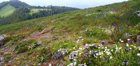
Photo credit: USDA Forest Service
Wilderness Areas/Wild & Scenic Rivers
Drift Creek Wilderness - On the Drift Creek Wilderness, towering Sitka spruce and western hemlock, that sometimes reach seven feet in diameter, shade the Coast Range’s largest rainforest stand of old growth.
Cummins Creek Wilderness - Cummins Creek Wilderness features the only old-growth Sitka Spruce forest in the Oregon Wilderness System.
Rock Creek Wilderness - Rock Creek Wilderness is one of Siuslaw National Forest’s most remote wildernesses with no developed trails and trailheads.
Devils Staircase Wilderness - The Wilderness also encompasses some of the most remote and rugged terrain on the Siuslaw National Forest, characterized by steep creek drainages, sheer sandstone cliff faces, unstable soils, and dense vegetation.
Invasive Species


| subjectnumber | Subject Name | Scientific Name | |
|---|---|---|---|