Ozark-St. Francis National Forest
Fishing and canoeing are popular activities on this Forest with many mountain streams offering smallmouth bass, sunfish, and trout.
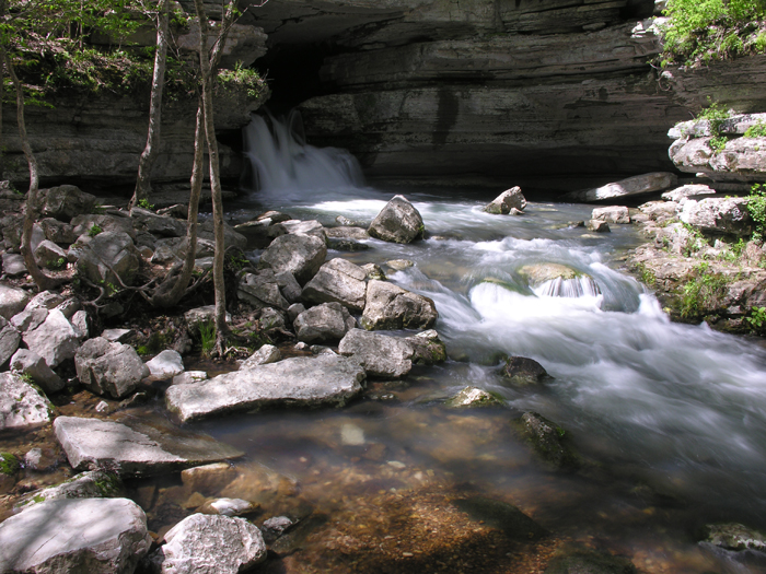
Photo credit: USDA Forest Service
Wilderness Areas/Wild & Scenic Rivers
East Fork Wilderness - Hiking is a popular recreational activity in the East Fork Wilderness as well as horseback riding.
Hurricane Creek Wilderness - The Ozark Highlands Trail and Hurricane Creek Wild and Scenic River run through the middle of the Hurricane Creek Wilderness.
Leatherwood Wilderness - Leatherwood Wilderness is spotted with stands of native shortleaf pine as well as the unique cedar glades nestled within the primarily oak, gum, and hickory forest.
Richland Creek Wilderness - Richland Creek Wilderness was created by the 1984 Arkansas Wilderness Act and contains 11,801 acres in the middle of the Boston Mountains.
Upper Buffalo Wilderness - There are four developed access points to reach the Upper Buffalo Wilderness: Hawksbill Crag, Kapark Cemetery, Dahl Memorial, and Boen Gulf.
Mulberry River - Mulberry River has been recognized by Arkansas Game and Fish Commission as one of the premier smallmouth and spotted bass fisheries in Arkansas.
Buffalo River - The Buffalo River is managed for smallmouth bass with special length and creel limits.
Richland Creek - Richland Creek Falls, Twin Falls, an upland swamp, fossiliferous limestones and smallmouth bass fishing are some of the features of this Ozark Mountain's stream as it flows through the Richland Creek Wilderness.
Hurricane Creek - Hurricane Creek River's outstanding scenery is characterized by sharp ridges and cliffs, unusual rock formations and clear reflecting pools.
Big Piney Creek - Big Piney Creek supports plant species considered by the Arkansas Heritage Commission to be sensitive.
North Sylamore Creek - North Sylamore Creek flows through the Blanchard Springs Recreation Complex, which provides camping, swimming and hiking, and includes the famous Blanchard Caverns.
Invasive Species


| subjectnumber | Subject Name | Scientific Name | |
|---|---|---|---|